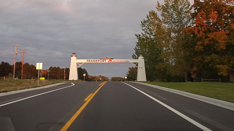
Frankfort, Michigan – October 21 – 23, 2016
This post is a little different than most of the trips that you find on our site. It was an adults only weekend and we actually stayed in a hotel instead of our camper. We planned to do something for our anniversary, but summer is always busy so we decided to wait until fall and do a color tour. We booked a room in Frankfort and our plan was to drive up the famous M-22 route, stopping at some of favorite spots and some new places we had not been to.
This would typically be the peak color weekend in Northern Michigan, but as you will see from our photos we were about a week early this year. Although, the nice sunny weather made up for the spotty color.
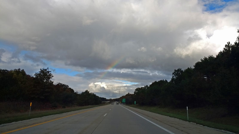
Scattered lake effect rain showers made for some interesting weather on Friday night. We saw 4 different rainbows as we headed north.
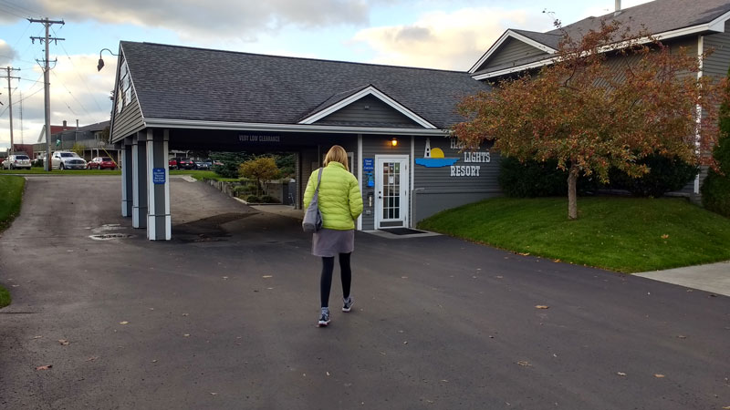
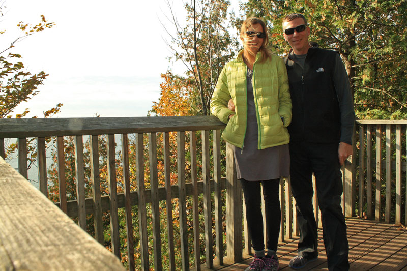
Our home for the weekend was Harbor Lights Resort in Frankfort. In the past we have stayed in Traverse City, but this time we thought that a smaller, less busy area would be a nice change. We were surprised as we rolled into town that it was packed. As we checked in, we found there was a weekend film festival going on. It was a little busy, but overall we still ended up with the small town feel we were looking for.
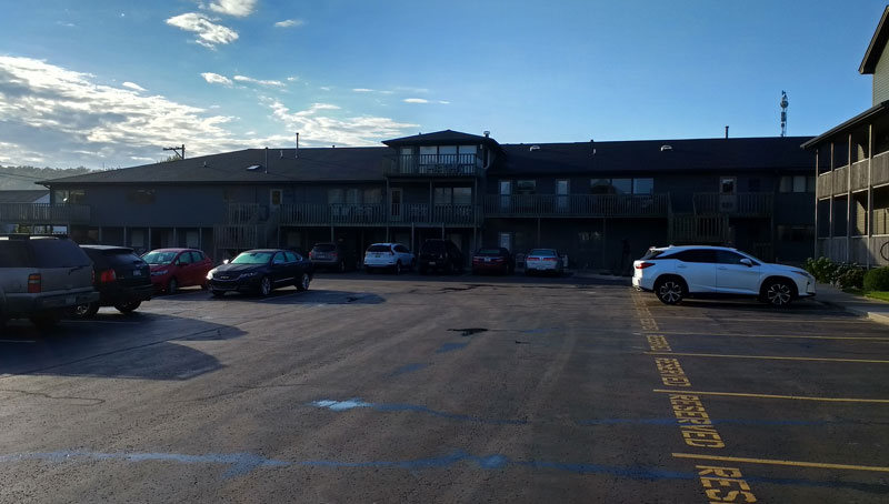
Harbor Lights is located right on the water and has both motel rooms and 1, 2 or 3 bedroom condominiums. Our room was on the lower level in the building pictured. We thought that overall the room was nice and well maintained and the off-season rates were fairly reasonable.
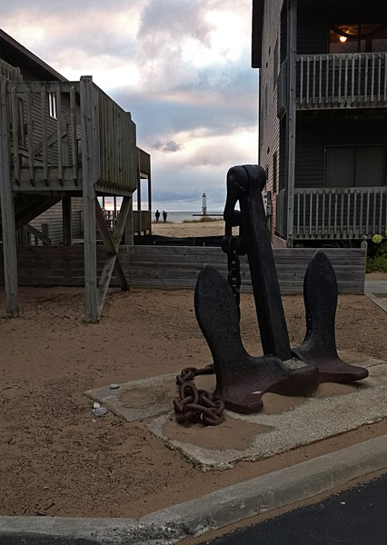
The view of the Frankfort Harbor from right outside our room.
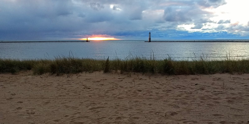
Before walking into town for a late dinner we stopped to watch the sun drop out below the clouds and into Lake Michigan.
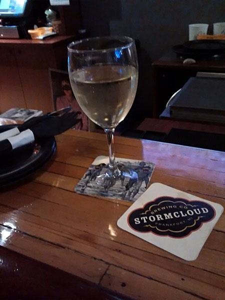
Stormcloud Brewing Company was our dinner stop for the evening. We were lucky to get a couple seats at the end of the bar, because shortly after we arrived people lined up waiting for tables. It looked like we made it just before a movie let out. The menu mainly consists of appetizers and flatbread pizzas. There are also a few soups, salads and sandwiches. Everything looked good, but we decided on the pizza and were happy with our choice.
We didn’t want to give up our good seats at the bar, but all to soon it was getting late and we wanted to try and get an early start in the morning.
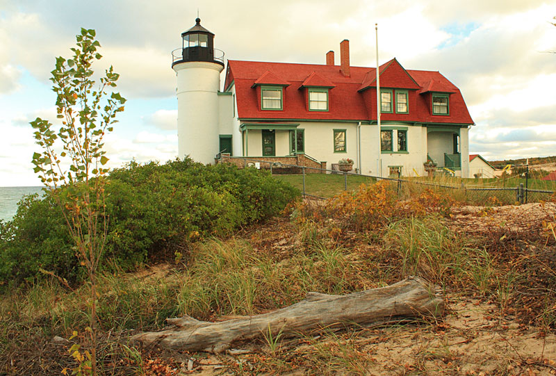
With just the 2 of us we made quick work of getting ready the next morning. For breakfast we stopped in the resort office for the complementary donuts and coffee. We were soon rolling north up M-22 to our first stop at the Point Betsie Lighthouse.
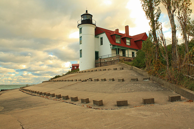
The Point Betsie Lighthouse is probably the most photographed lighthouse in Michigan. I had visions of a shot with the morning sun hitting the tower, but the clouds didn’t cooperate on this morning. We walked around the grounds and then continued on.
More on the Point Betsie Lighthouse: www.pointbetsie.org
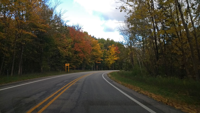
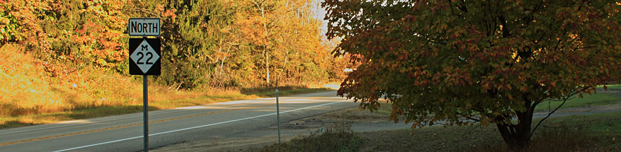
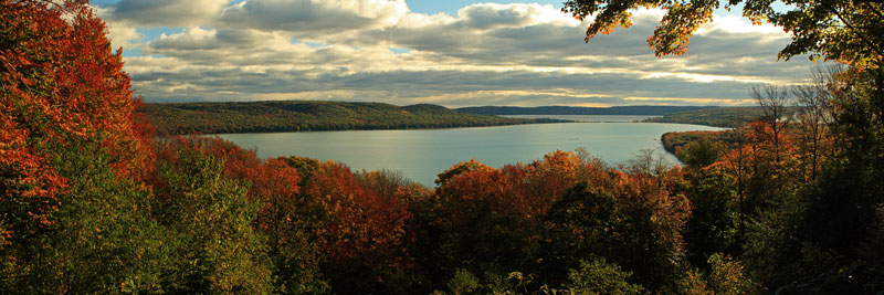
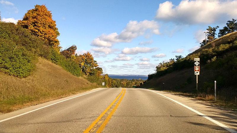
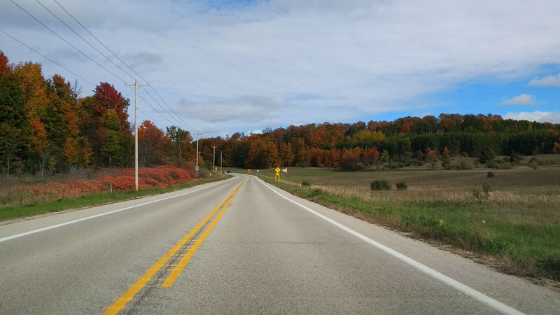
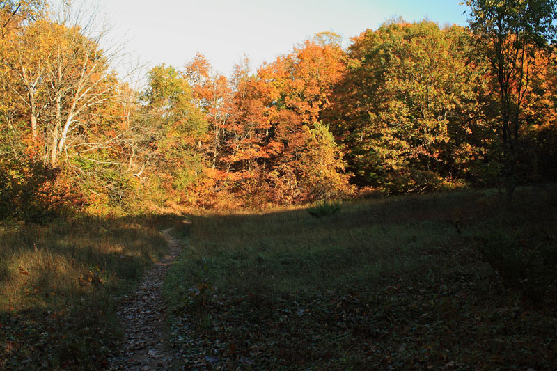
Back on M-22 just north of Crystal Lake.
The Pierce Stocking Scenic Drive – Sleeping Bear Dunes National Lakeshore
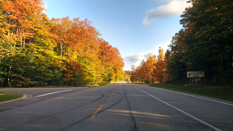
Just after the village of Empire we turned off from M-22 and on to M-109. By the time we made it to our next stop at the Pierce Stocking Scenic Drive the sun was starting to come out.
This 7.4 mile drive in Sleeping Bear Dunes National Lakeshore is a must see if you have not been up here before. The single lane road winds though forest and open dunes and stops at some of the most spectacular overlooks in Michigan.
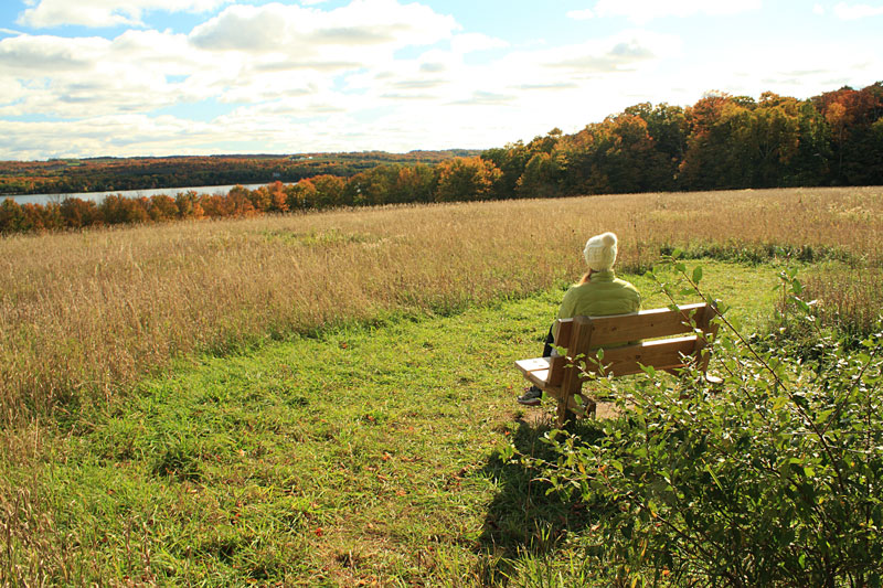
Our first stop was at the #2 marker for the Glen Lake Overlook.
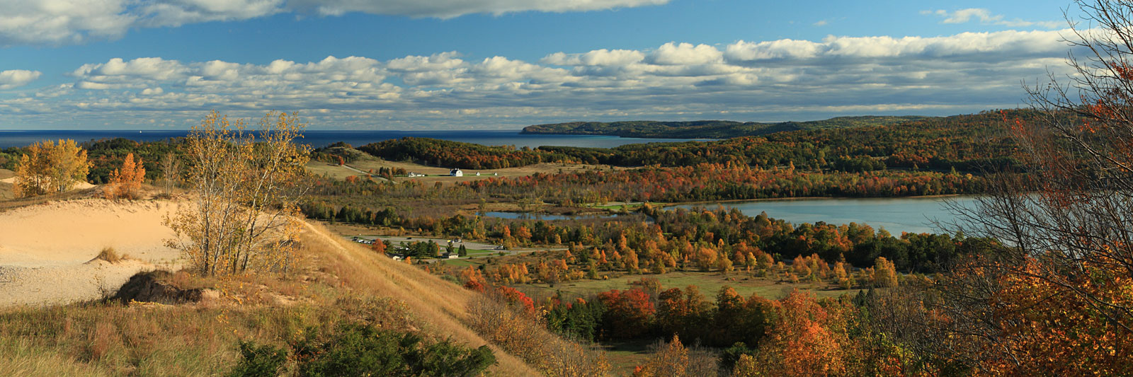
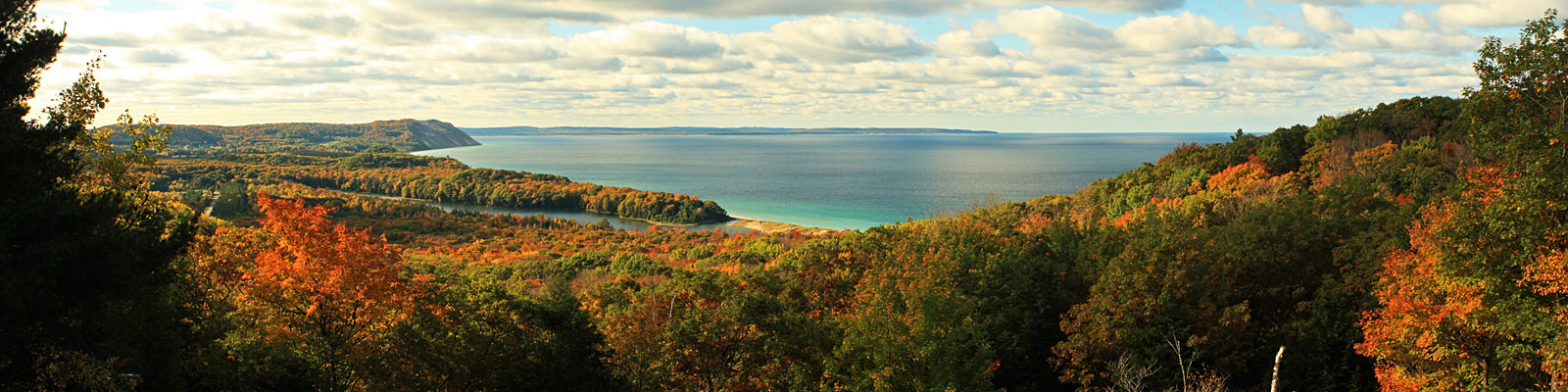
Just a little further down the road is one of our favorite views at the Dune Overlook.
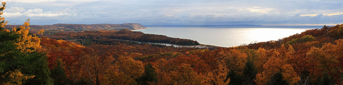
The panoramic view from the Dune Overlook. Click the photo to see larger.

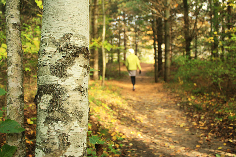
It was still pretty green in the forest sections.
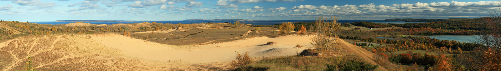
The Lake Michigan Overlook at #9 is the most popular stop on the drive.
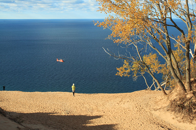
The Coast Guard on patrol at the Lake Michigan Overlook.
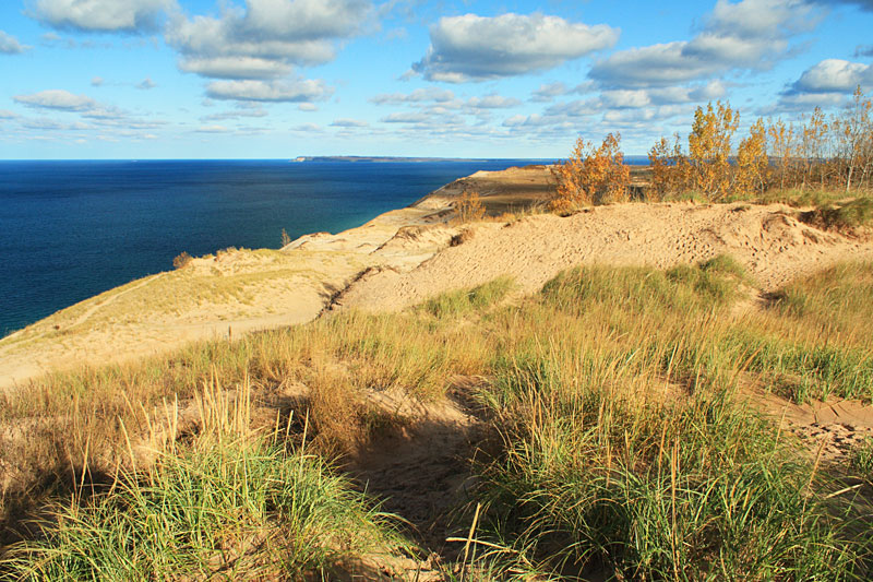
Our final stop at the North Bar Lake Overlook.
For more information on Pierce Stocking Scenic Drive See the Virtual Tour on the NPS website.
After the Scenic Drive we continued on M-109 and then picked up M-22 again in Glen Arbor.
T

Using a Circular Polarizer Filter for shots like this can help make the colors really pop. When adjusted properly the polarzing filer cuts down the glare and reflections that your camera sees. The result is darker skies and bright blue water.
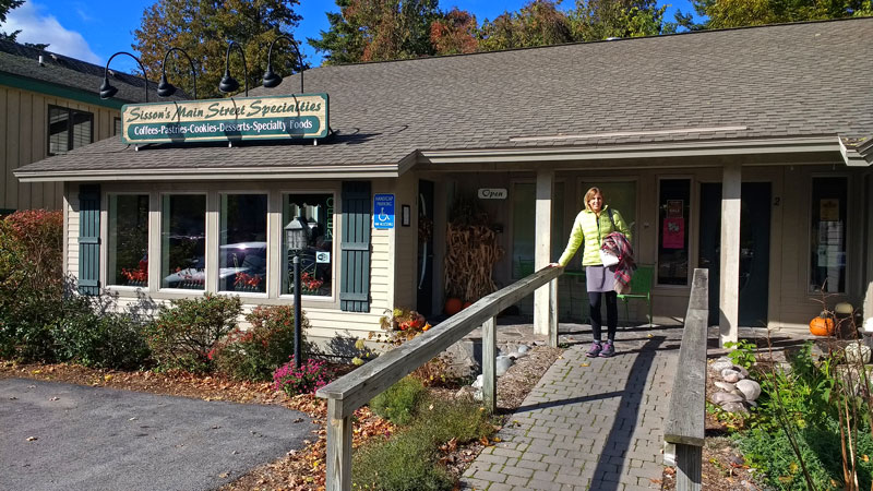
We planned to stop at the Village Cheese Shanty in Leland to pickup some sandwiches for lunch. Unfortunately, this was their last weekend of the season and they were not making sandwiches. The girl at the counter recommend Sisson’s Main Street Specialties on the north end of town. We were glad she pointed us here, because we would not have found this nice little place on the edge of town. We enjoyed some awesome sandwiches in their small indoor seating area.
Clay Cliffs Natural Area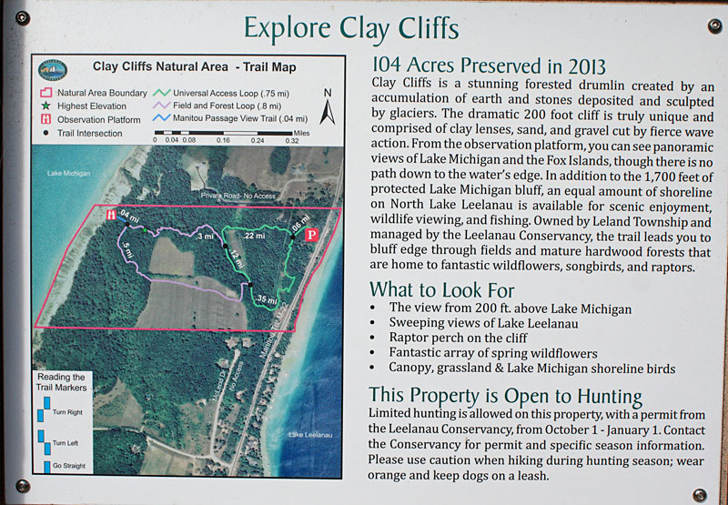
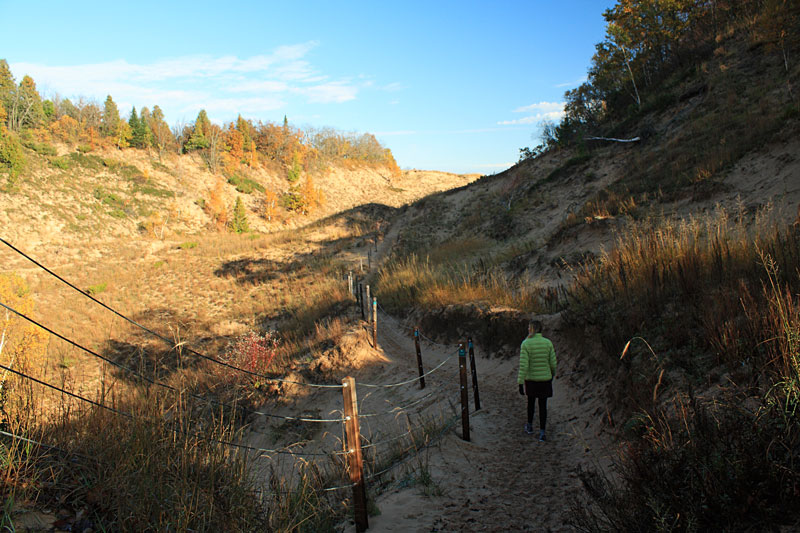
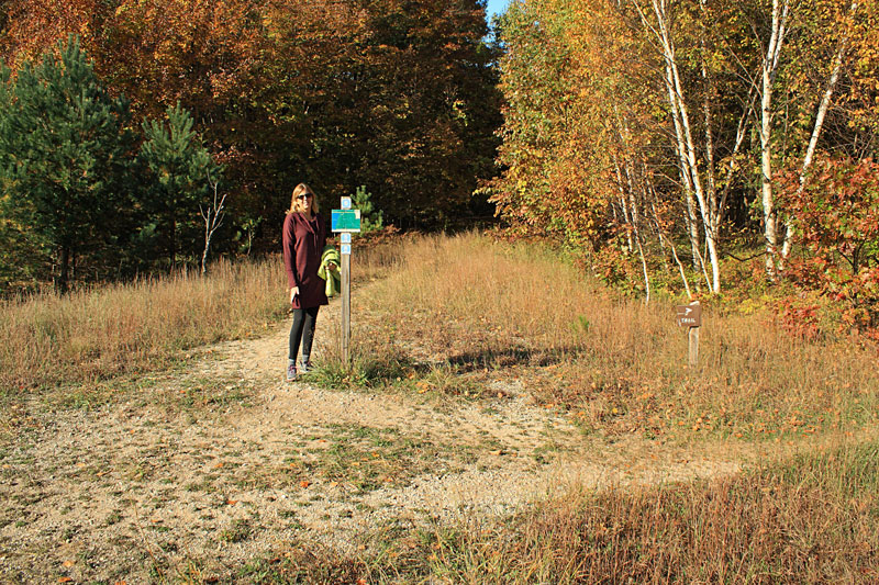
Just 2 miles north of Leland we stopped for our first hike at Clay Cliffs Natural Area. Clay Cliffs is protected by the Leelanau Conservancy. The small 104 acre preserve has a little bit of everything from hilly forest to open meadows and 0.3 miles of Lake Michigan Beach.
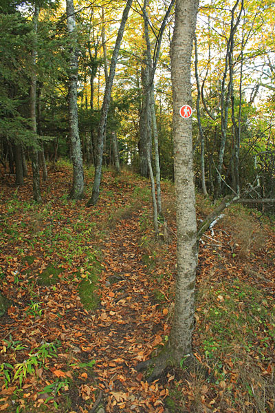
Clay Cliffs can be explored on a 1.5 mile figure 8 trail system. We set out hiking the outside of the loops in the counterclockwise direction.
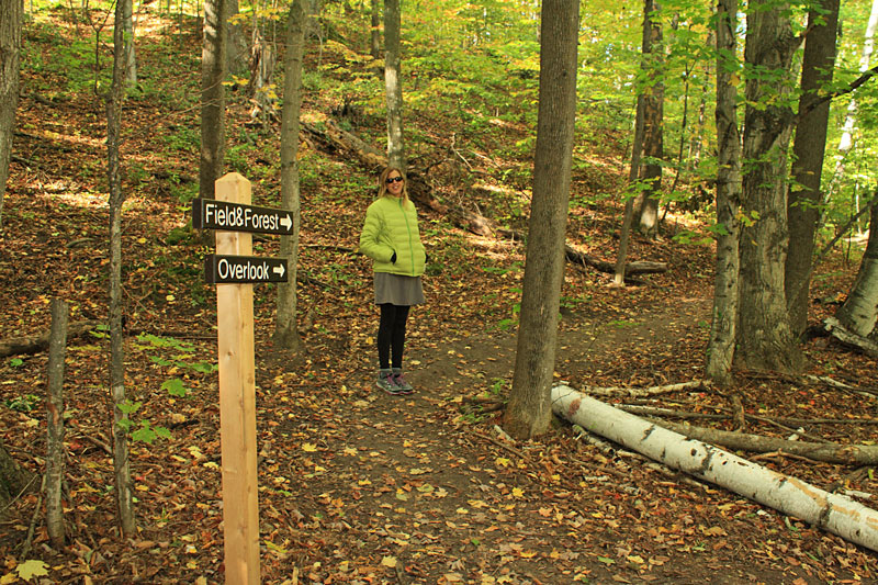
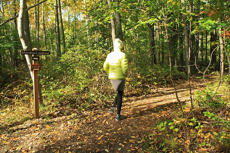
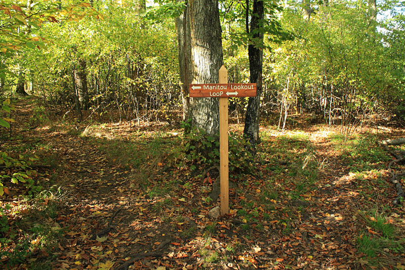
At the next intersection we stayed to the right heading towards the overlook.
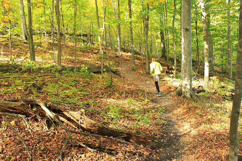
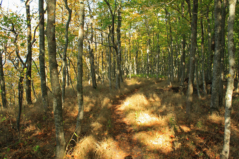
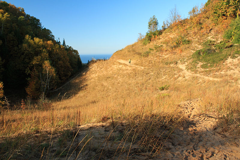
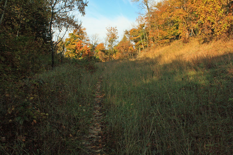
We met a few other hikers as the trail started climbing. Everything was still pretty green near the lakeshore. I have noticed that the leaves right near the Big Lake seem to change color about a week later than those inland.
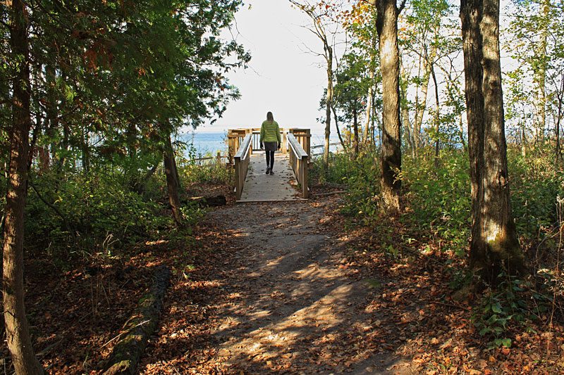
Approaching the Manitou Lookout platform.
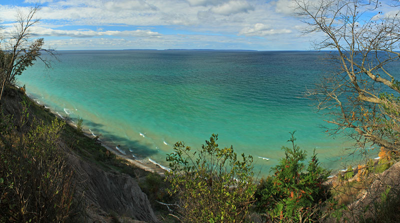
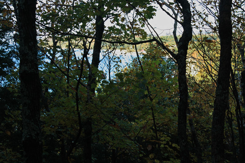
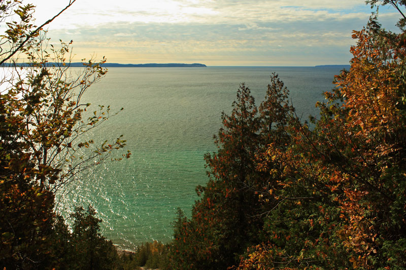
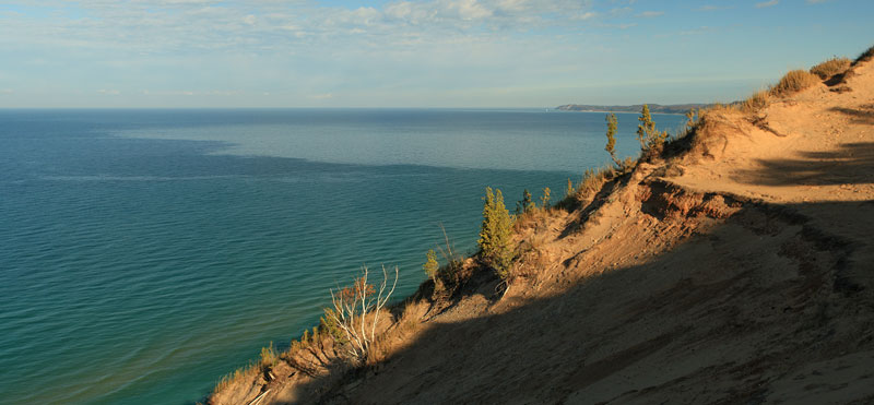
The overlook is perched on the namesake clay cliffs about 200 feet above Lake Michigan. The Manitou Islands and Pyramid Point can be seen on the horizon above the emerald water.
About a 0.25 mile past the overlook the trail breaks out into a clearing as it starts descending back down to the road.
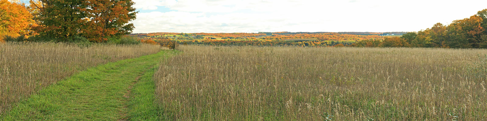
The clearing opens up to nice views of Lake Leelanau as you loop back to the trailhead. We would recommend doing the loop in the counterclockwise direction to keep this view in front of you as you walk.
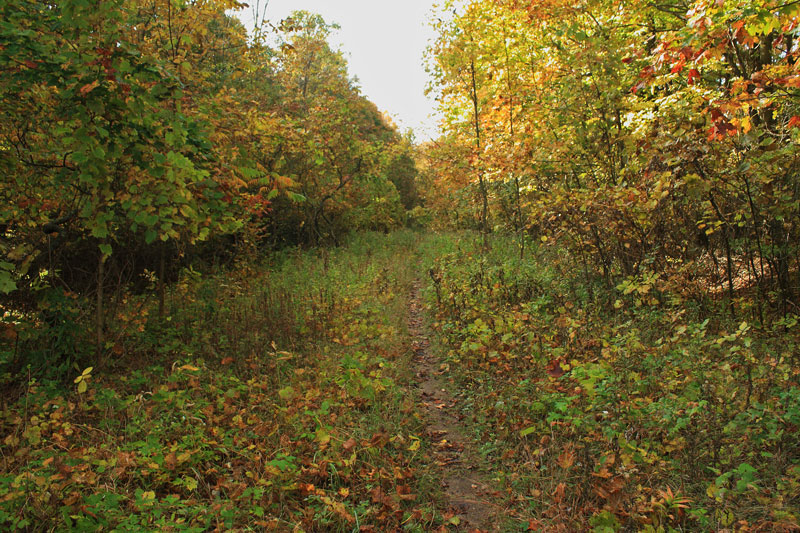
The last 0.3 mile of the hike drops back into the trees and levels out. The trail parallels M-22 and you start hearing the traffic as you near the trailhead.
Clay Cliffs Natural Area has been on our to-hike list for a while and we were not disappointed. We will definitely be back with the kids.
Find more on Clay Cliffs Natural Area on the Leelanau Conservancy website.
Clay Cliffs Natural Area Trail Map.
From Clay Cliffs we continued north towards the end of the Leelanau Peninsula.
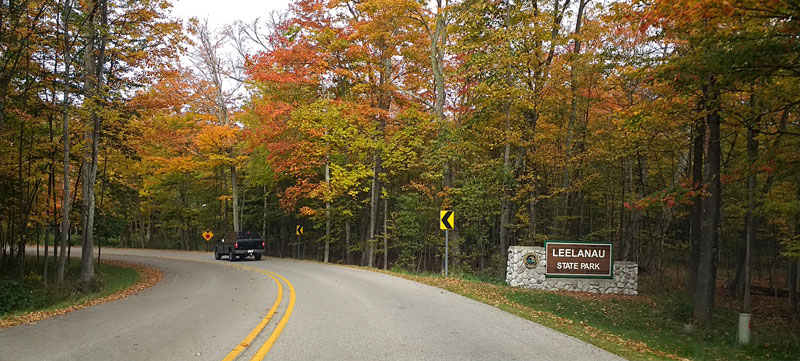
In Northport, Michigan M-22 turns back south and runs along the east shore of Grand Traverse Bay. We decided to leave M-22 and continue north on M-201 all the way to the end of the road at Leelanau State Park. We soon found that we were not the only ones making this our destination for the afternoon. There was a line at the contact station and the parking area was nearly full.
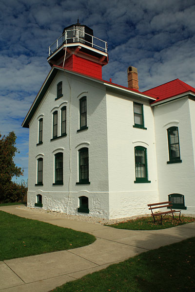
Leelanau State Park protects over 1,300 acres right at the tip of the Leelanau Peninsula. The park is split into 2 separate areas. The small part right at the northern most part of the peninsula has the 52 site rustic campground and a day use area by the Grand Traverse Lighthouse Museum. Access to the main acreage of the park is a 5 miles south of here. This where you will find all of the parks 8.5 miles of hiking trails and 1.5 miles of sandy beach along Cat Head Bay.
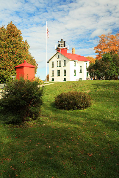
We had Toured the Grand Traverse Lighthouse on a previous visit to the park so this time we just stretched our legs walking around the grounds.
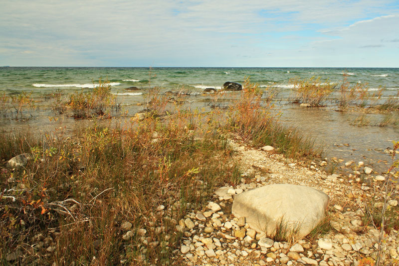
Looking out to Lake Michigan from the very tip of the Leelanau Peninsula.
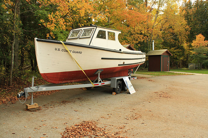
A new addition to the Museum is this 26′ Cabin Motor Launch. This boat was built in 1945 and was used to service the North Manitou Shoal Light until 1959. Funds are currently being raised to restore this unique piece of Manitou Passage history.
One more parting shot of the Grand Traverse Lighthouse.
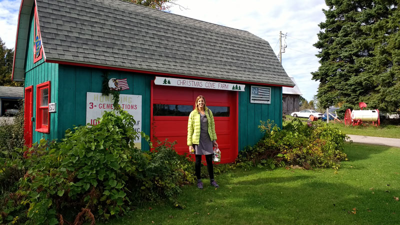
Our next stop was about 6.5 miles south of Leelanau State Park at the Christmas Cove Farm. Owner John Kilcherman specializes in “Antique Apples” and now grows over 250 varieties, many of which are not longer commercially available.
From their website: “What is an Antique Apple? It is an apple that our ancestors grew and enjoyed. The origins date back in time, with varieties from the 1600s, 1700s, 1800s and early 1900s. They come from many foreign countries, as well as many states here in America.
The flavors are a tasty treat; an experience to remember for years. They are very unique, and some varieties are extremely rare. Eat them sliced and you will be in for a gourmet experience. Enjoy the wonderful aroma, which will enhance the delightful tasting fun of every apple.”
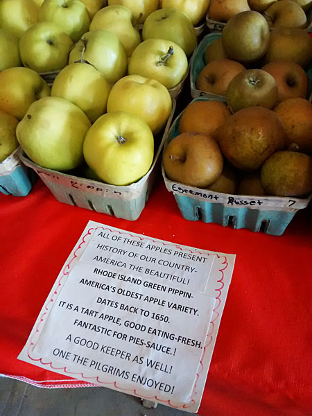
Pilgrim apples.
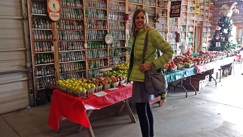
We fought our way through all the tall boots and infinity scarfs and picked up a bag of apples to take home and and a single for the road.

With all of the different varieties here it was a little overwhelming. Kim remembered that the Spy apples were often used for pies in her Eet Smakelijk Dutch cookbook. So this is what we went with and the pie was one of her best ever!
Christmas Cove Farm is open everyday from mid-September to mid-November.
More Information at: christmascovefarm.com
After the apple farm we found our way back to M-22 and continued down along the east shore of the Leelanau Peninsula. It was a nice drive with more views of the water than the west side. Just before the town of Sutton’s Bay we tuned right and cut back across the peninsula on M-204. We wanted to get one more short hike in at Whaleback Natural Area just south of Leland.
Whaleback Natural Area
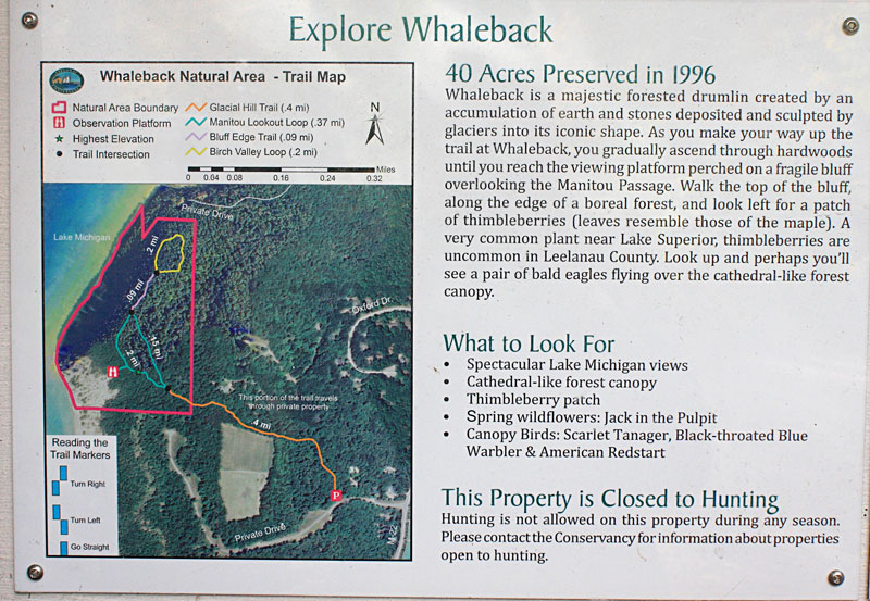
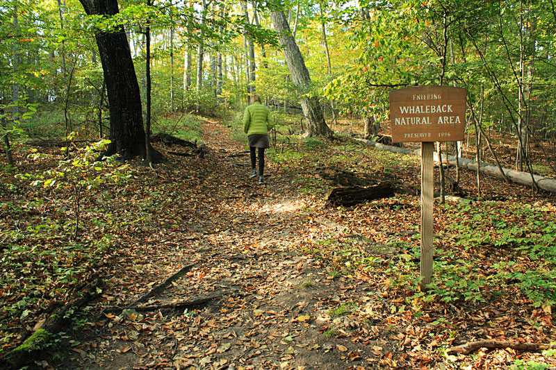
Whaleback Natural Area is another Leelanau Conservancy property. This small 40 acre preserve protects a moraine that rises 300 feet above Lake Michigan. Whaleback has a 1 mile trail system that is basically an out and back hike with a couple small loops at the end.
Whaleback is accessed by a 0.4 mile connector trail that runs through private property. The trail is sandwiched between a subdivision and vineyard. The trail starts climbing almost immediately on a nice gradual slope toward the top of the bluffs.
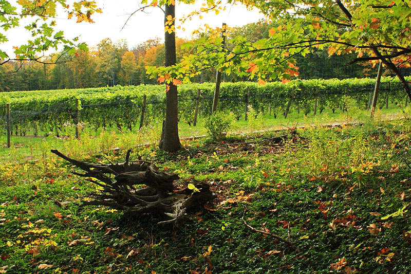
They were just finishing a day of picking grapes as we passed the vineyard.
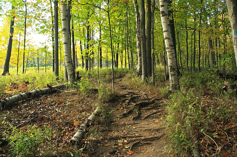
Continuing the steady climb as we entered the Natural Area property.
At the top we stayed to the right and hiked the loop before checking out the overlook.
The trail turned to narrow single track as we skirted along the edge of the bluff. We passed a thimbleberry patch and I think this is the only place I have seen them in the Lower Peninsula. Too bad we were a couple months past berry picking season.
At the end of the loop through is a partially obstructed view of the Leland harbor. It is probably better after the leaves are down.
Looping back to the overlook along the edge of the steep slope covered in stunted hemlock trees.
Looking out towards Pyramid Point from the overlook platform.
There was a cool breeze blowing in off the water. We only stayed long enough to take a few pictures and then started descending back towards the trailhead.
Heading back down through a nice older growth forest.
It took 1.6 miles of hiking to go out and back and do the loops. The 0.5 mile trail to the overlook and back was well worn and appears to get the majority of the traffic. This was another first visit for us and we were really glad that we decided to drive over and check it out.
Find more on Whaleback Natural Area on the Leelanau Conservancy website.
Whaleback Natural Area Trail Map.
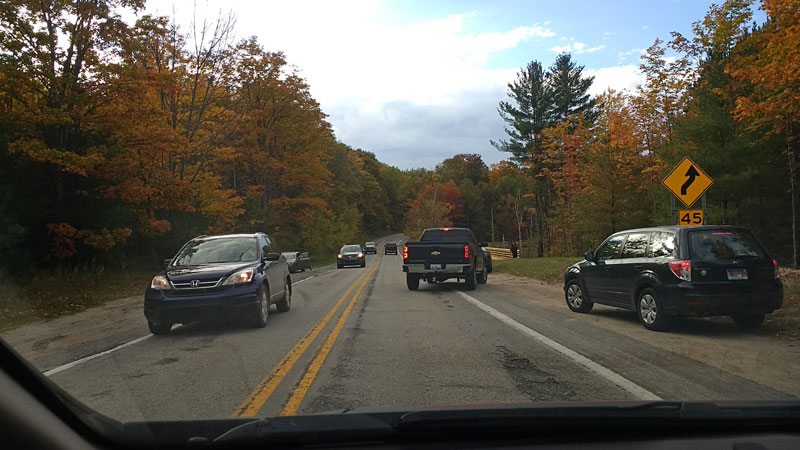
After stopping at Whaleback it was time to make our back to Fankfort and get ready for dinner. It was pretty slow going with all the color tour traffic heading both directions on M-22.
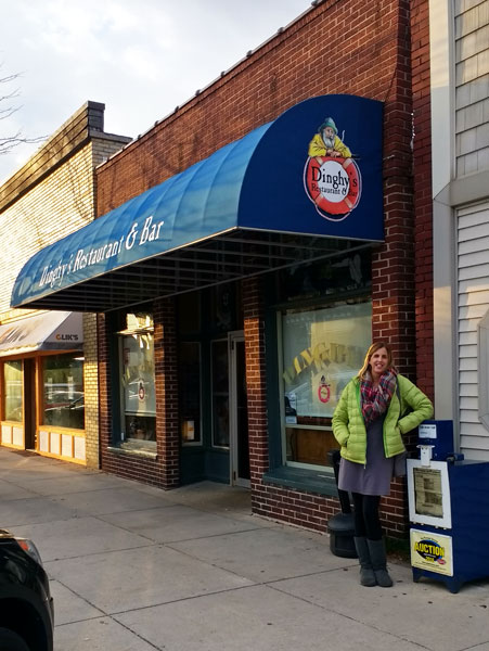
By the time we finally made it back to downtown Frankfort we were starved so pulled right into an open parking space in front of Dinghy’s Restaurant and Bar and went in to check it out. We are always up for any restaurant with a nautical theme and this ended up being a excellent choice. The food was much better than your typical bar and grill. Order anything that has one of their 6 different smoked meats in it and you will be very happy. Just thinking about the Smoked Trifecta Sandwich again is making my mouth water.
More at: dinghysrestaurant.com
We had one more thing on our list for the day so we got back in the car headed up the hill and out of town.

This is Michigan wine country and we had to visit at least one winery while we were here. After a full day cruising around the Leelanau Peninsula it felt good to relax on the heated porch at St Ambrose Cellars and sip some wine and mead as the sunset.
St Ambrose is about a 15 minute drive from Fankfort and it is one of the only wineries that is open later into the evening on the weekends.
More at: stambrose-mead-wine.com
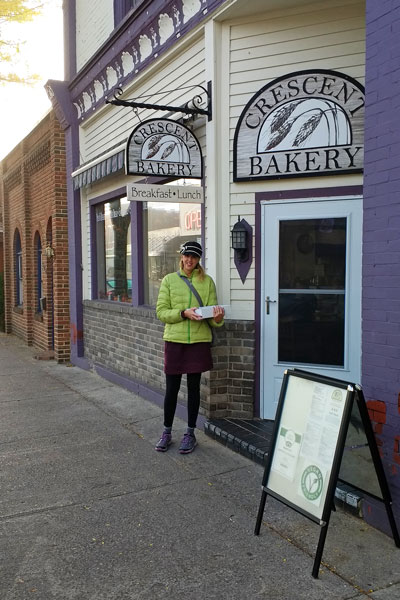
The next morning we had doughnuts and coffee at Harbor Lights Resort again. Then we walked into town to pick up some more doughnuts from the Crescent Bakery to take home for the kids. This little bakery was packed for breakfast. It looked to be the only thing that was open in Frankfort on Sunday morning.
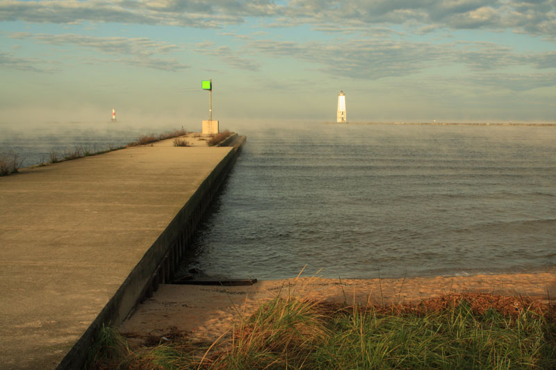
On the way back to Harbor Lights we walked along the waterfront and watched the fog blow out past the Breakwater Lighthouse.
Weekends always go too fast and it was already time to pack up and check out of the Harbor Lights Resort. By 9:30 we were back in the car sipping coffee and heading south.
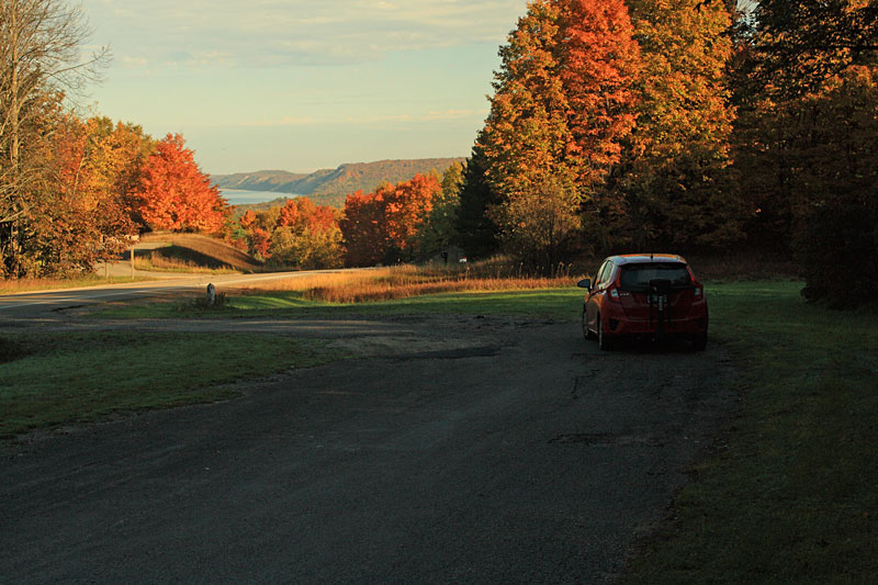
Morning sun at a scenic pullout near Arcadia Dunes.
We bought the Honda Fit a little over a year ago so we would have an economical way to shuttle our kids all over town for their various activities. It also worked out really well for our color tour. We averaged over 40 mpg and only spent about $20 in gas for the weekend. It is not as comfortable as our van, but it was more fun to drive on all the M-22 curves.
Arcadia Dunes – C.S. Mott Nature Preserve
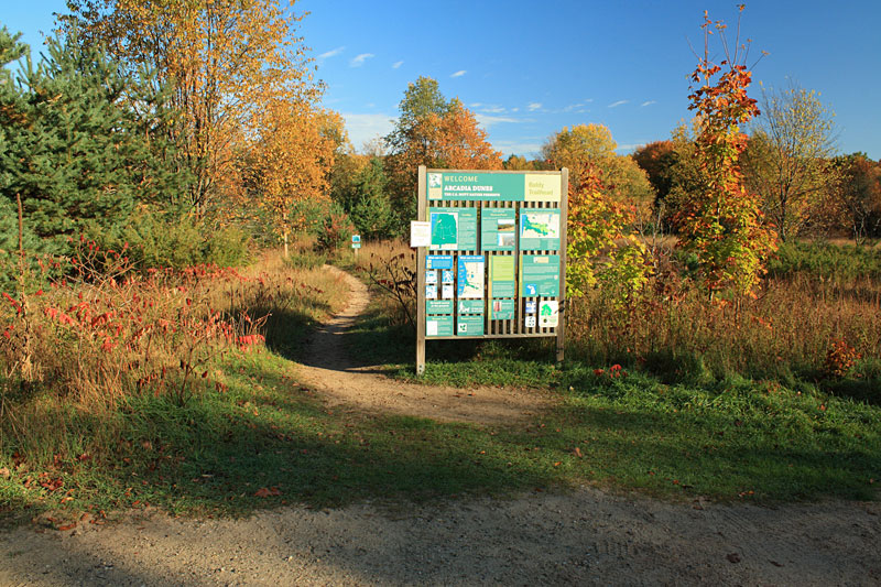
The morning was cool, but sunny. We wanted to get one more hike in so we stopped at the Baldy Trailhead in Arcadia Dunes.
The Arcadia Dunes C.S. Mott Nature Preserve is operated by the Grand Traverse Regional Land Conservancy and protects over 3,600 acres. Arcadia Dunes has become one of my favorite places to visit. There are 15 miles of multi-use trails. The fast and flowing 11 mile Dry Hill Trail is one of the top mountain bike routes in the Lower Peninsula. The 3.8 miles of trails that can be accessed from the Baldy Trailhead are open to bikes, but are better for hiking. They have nice Lake Michigan views without the crowds you see in Sleeping Bear Dunes.
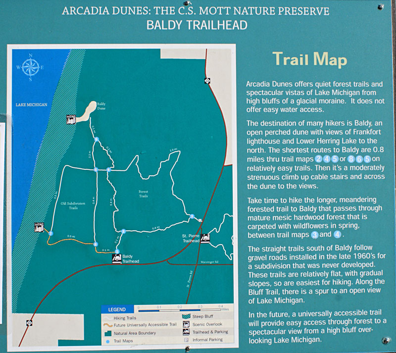
The route we chose included both of the overlooks following the markers is this order: 1, 2, 4, 5, 6, 7, 8.
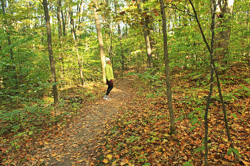
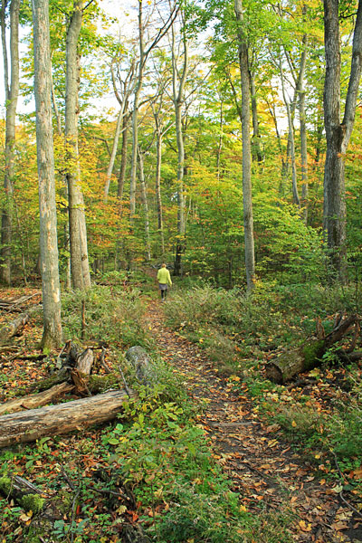
The hike started out fairly flat through a nice hardwood forest.
After about 0.7 miles you break out into a clearing and then climb up a steep section of cable stairs.
At the top of the climb is the open dune area known as “Old Baldy.”
The trail circles out around a low area and out to the Lake Michigan overlook.
The view from the Baldy overlook. It couldn’t find the height, but I am guessing the dunes are around 300 feet above Lake Michigan.
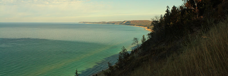
The panoramic view from the edge of the blow-out. The Frankfort Lighthouse can be seen on the horizon. Click the photo to see larger.
After taking in the view for a little while we backtracked down to post #5 and then took the split right to post #6 above.
From post #6 the trail heads straight back towards the Lake on a steady incline. According to the contact board: “The straight trails south of Baldy follow gravel roads installed in the late 1960’s for a subdivision that was never developed.”
The trail turns left and runs parallel along the Lake, but it is fairly overgrown and far enough inland that you can’t see the water.
Just before the trail turns back towards the trailhead there is spur trail out to the second overlook. The view is not as open as the Baldy Overlook, but as we approached a bald eagle flushed from a tree up on the bluff.

From the overlook it is 0.4 miles back to the parking area on a wide well traveled path. They were starting to work on the planned universally accessible trail. By next summer this path will probably look a lot different.
The route we followed was just under 3 miles and was a nice way to end our weekend.
Find more on the Arcadia Dune C.S. Mott Nature Preserve on the GTRLC website.
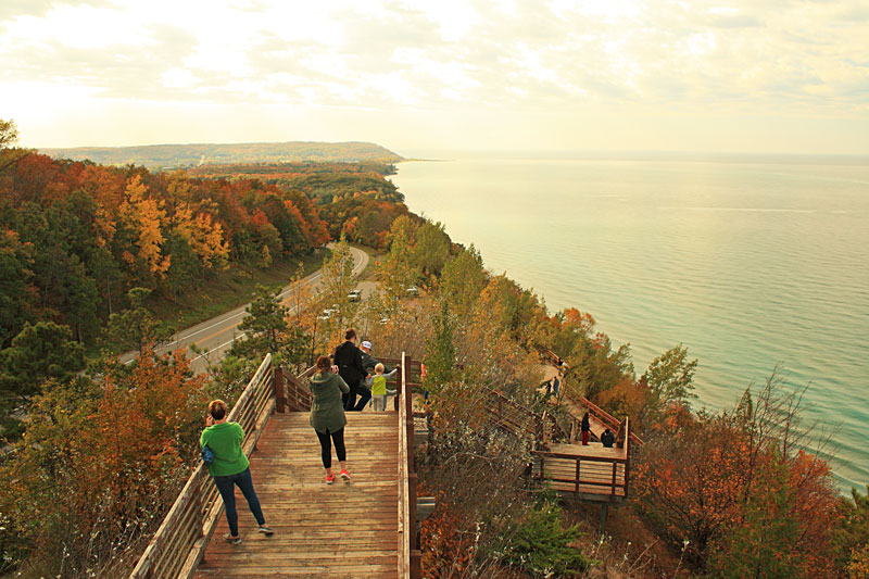
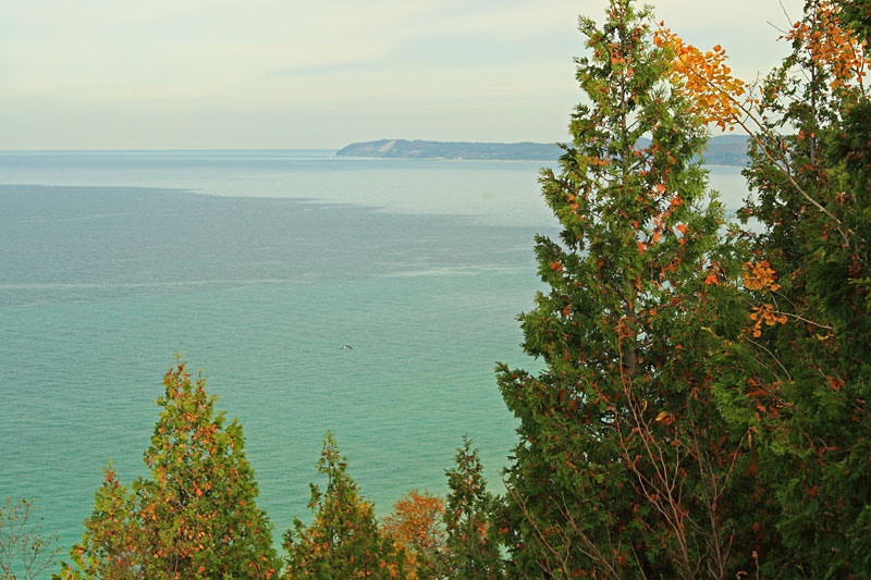
Our final stop along M-22 was the Arcadia Overlook which is also called “Inspiration Point.” This is the highest point along the west shore of Lake Michigan. The parking area is already 370 feet above the water and from there 120 steps take you up another 80 feet to a viewing deck. The scenic pullout is 2 miles north of the small town of Arcadia.
-The End-
![]()
![]()
![]()
![]()
![]()

I am often asked about the camera that I use for the photos on this site. We are starting to use our cell phone cameras more because of the convenience and improved quality. However, when I want to good quality photo it is still hard to beat my old Cannon DSLR camera.
I have been using a relatively inexpensive Canon Rebel XS with the 18-55mm lens for several years now. This trusty old camera only has a 10MP sensor, but the photos still look better than our 16MP point-and-shoot. For outdoor shots I often use a Circular Polarizer Filter to reduce glare and make the sky and other colors really pop.
Search for Canon DSLR Cameras on Amazon >>
Advertising Disclosure: We may receive a commission if you click a link on our site and purchase one of the products or services that we recommend.
Leave a Reply